Ex-Josephine brings high winds and maybe snow to East Coast
This story deserves to be shared
Send it to someone who'd care, or post it on your networks.

Parts of Atlantic Canada may be in for a rough start to the weekend, with forecasters keeping a close eye on the system formerly known as Subtropical Storm Josephine. The storm has been meandering up the Eastern Seaboard this week as a powerful low-pressure system but has now reached cold North Atlantic waters. DON'T MISS: Canada's Winter Sneak Peek: El Niño puts record warmth in playThe system will swipe southern Atlantic Canada with potent wind gusts, heavy rainfall, snowfall and three- to five-metre waves along the coastal areas, elevating the risk of flooding. Low-pressure systems exist on a spectrum between tropical and extratropical (non-tropical). Josephine has slipped across the spectrum in both directions several times over the past week. Originally a strong nor’easter, the system evolved into a subtropical storm on Wednesday before returning to its roots on Thursday. A subtropical storm is one that has characteristics of both a tropical and extratropical system, a sort of hybrid storm that can bring hazardous weather to the affected regions.
This article is an excerpt. To read the full content, visit the original source. The Weather Network
Related articles
November hurricanes are still possible as the season winds down
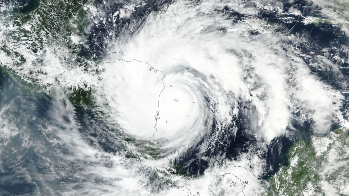
A hurricane is the farthest thing from our minds as the leaves change and temperatures drop. But the season isn’t done just yet, and even a quiet season can have a few tricks up its sleeve heading into late autumn. Here’s a look at what we might expect over the next couple of weeks as we enter the final stretch of this near-record quiet hurricane season. DON’T MISS: Autumn can still produce intense hurricanes across the AtlanticA raging El Niño in the neighbouring Pacific Ocean has kept this Atlantic hurricane season exceptionally quiet. Nine of this year’s ten named storms only achieved tropical storm intensity. Isaias, which set a record for its lateness, grew into the season’s sole hurricane before it slammed into Florida’s coastline on Oct. 9. Atlantic hurricane season officially runs through Nov. 30. Based on climatology, a little more than 90 per cent of an average hurricane season’s total activity is behind us by the weekend before Halloween. Content continues belowBut that remaining 10 per cent can pack a punch if all the right conditions align. The most likely spot for tropical formation this late in the season is the western Caribbean Sea and the southwestern Atlantic.

Halloween forecast: Will your costume need a winter coat?
Halloween is almost here across Canada! Before you put the finishing touches on your costume, you might be wondering: Will the weather co-operate? A tale of two seasons is beginning to take shape, with some Canadians facing an early taste of winter, while others could be enjoying a surprisingly mild trick-or-treat. The catch: Although we can give you some guidelines for temperature projections, nailing down a three-hour, trick-or-treat window will be futile a week out for those of us on the edge of precipitation chances. The divideAll three major weather models are showing a similar temperature divide brewing across Canada into the spooky Halloween weekend. Colder-than-seasonal temperatures are expected across parts of Western Canada, and unusually mild conditions farther east. Content continues belowParts of B. C. and Alberta could shiver through temperatures several degrees below seasonal, while the eastern Prairies and Ontario could enjoy temperatures well above what late October normally delivers. Disclaimer: Above-seasonal doesn’t necessarily mean warm. Remember it’s all relative this time of year, especially when the sun goes down.

Powerful Hurricane Vance slowly approaches Mexico as Typhoon Champi leaves 500+ injured in Taiwan
Waves crash against concrete wave breakers along the coast as Typhoon Champi approaches Taiwan, in Keelung on October 23, 2026. ((Photo by I-HWA CHENG / AFP via Getty Images)) prevnext

Champi kills 1 and injures 350 in Taiwan overnight
Typhoon Champi sends towering waves over Taiwan harborChampi has killed one person and injured hundreds in Taiwan and has downed trees and knocked out power for hundreds of thousands of people. The storm's strong winds and rains continued overnight Friday into Saturday morning. ImpactsAlthough the storm is no longer a typhoon, it was the equivalent of a Category 3 Atlantic hurricane when it grazed Taiwan. Champi did not hit Taiwan directly, but the storm's span was large enough to impact most of Taiwan. The island's weather authorities said the storm was weakening Saturday morning and that by evening, the land warnings for the typhoon would be removed.(MORE: Hurricane Vance intensifies rapidly off Mexico's Pacific Coast)Taiwan’s Central Emergency Operations Center reported that 350 people were injured as of Friday night. The one death was a man who was washed away by waves in Taiwan’s Pingtung County, the island’s southernmost part. Power outages, canceled flightsThe storm knocked out power for 280,000 households, according to United Daily News, a local Taiwanese newspaper, citing the island's power authorities. But power had returned to 80% of households by Saturday morning.

Hurricane Vance intensifies rapidly off Mexico's Pacific Coast
This GOES-19 GeoColor satellite image provided by the National Oceanic and Atmospheric Administration (NOAA) and taken on Friday, Oct. 23, 2026, shows Hurricane Vance in the Pacific.(NOAA via AP)Hurricane Vance rapidly strengthened into a Category 2 storm Friday as it neared Mexico’s Pacific Coast, the National Hurricane Center said. Vance had maximum sustained winds of 110 mph as it churned about 385 miles south-southwest of Acapulco, according to an advisory from the Miami-based hurricane center. The storm was nearing major hurricane strength, the center said, though gradual weakening was expected to start by Saturday.(MORE: Typhoon Champi sends towering waves over Taiwan harbor)The hurricane's outer bands were already funneling gale-force winds and rough seas into Mexico's Gulf of Tehuantepec, the center said. An unusually busy Pacific hurricane seasonIt’s been an intense hurricane season in the Pacific Ocean, with storms spawning in assembly-line fashion near Hawaii and Mexico as El Niño conditions create unusual weather, like this week's severe flooding and tornadoes hitting the southwestern United States and the prolonged drought in Central America's Dry Corridor.

Hunter's Moon: When and where to see October's full moon
October’s full moon, known as the “Hunter’s moon” is coming this weekend, but weather might make the view a hit or miss for some areas. The full moon peaks late Sunday night, or early Monday morning, for anyone in the Eastern Daylight Time Zone: EDT: 12:12 am (Monday)CDT: 11:12 pm (Sunday)MDT: 10:12 pm (Sunday)PDT, MST: 9:12 pm (Sunday)Whether or not the weather will let you see the full moon is another question. A large cold front and developing low pressure system stretching across the middle third of the country will create less than ideal viewing conditions for the Plains and Upper Midwest. The Pacific Northwest is facing a similar problem with a storm system moving in from the Pacific Ocean. A super moon but not a supermoonIf you manage to get outside to view the full moon, you might describe the experience as “super”, but it is not in fact a supermoon. A supermoon happens when the moon is full at the same time as it is at its perigee, or the point in its orbit closest to the Earth. Get More of Our News on GoogleSet The Weather Company as a 'Preferred Source' to get quicker access to the news you value. The next two supermoons happen on Nov. 24 and Dec. 24.
0 comments
No comments yet. Be the first to share your thoughts!